Publish, share, and manage interactive web maps without the complexity. GoMap makes it easy to deliver geospatial information to employees, stakeholders, and the public through a simple, intuitive web mapping platform.
Geospatial data is one of your organization’s most valuable assets. It’s only useful if people can easily access and understand it.
IDX GoMap transforms complex GIS data into intuitive, interactive web maps that anyone can use. Whether you’re sharing infrastructure, property information, utilities, environmental data, or public services, GoMap helps organizations improve communication, support better decision-making, and extend the value of their GIS investment.
Built for Smarter Web Mapping
Interactive Web Maps
Publish dynamic maps that allow users to search, explore, and visualize geospatial information from any device.
Works with Your Existing GIS
IDX GoMap integrates seamlessly with leading GIS platforms, including Esri, MapInfo, Autodesk, and other FDO-compatible data sources, allowing you to publish maps without disrupting your existing workflows.
Accessible Anywhere
Provide secure access to geospatial information for employees, field crews, partners, and the public through a browser-based experience.
Request a Demo
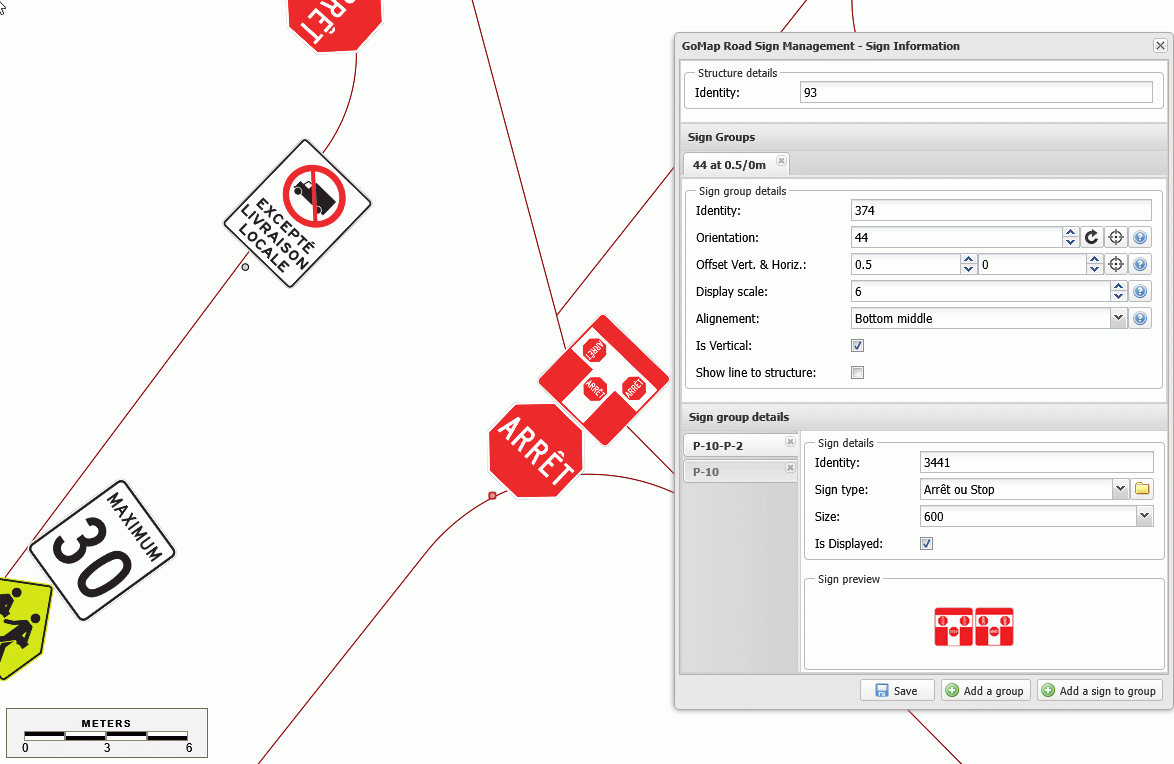
EASY SIGN MANAGEMENT
Reorder Your Signs in Seconds
Quickly change the order of your signs in IDX GoMap with a simple drag and drop. Keep your signage organized and make updates faster, without unnecessary steps.
CORE FEATURES
Everything You Need to Share GIS Information
WEB MAPPING
Publish Maps in Minutes
Quickly transform GIS data into interactive web maps that make information easier to understand and share.
DATA INTEGRATION
Connect to the GIS Tools You Already Use
Integrate with Esri, Autodesk, MapInfo, and other FDO-compatible data sources to publish information without duplicating your data.
COLLABORATION
Share Information With Anyone
Provide secure, browser-based access to maps for employees, field teams, clients, decision-makers, or the public.
Your GIS Is Only Valuable If People Can Use It
Make geospatial information accessible across your organization with interactive web maps that improve collaboration, transparency, and decision-making.
Organizations across North America trust GoMap to securely publish, manage, and share geospatial information while improving collaboration and supporting better location-based decisions.
Built to Make GIS Accessible
Simple to Use
Make complex GIS information accessible through an intuitive web interface designed for both GIS professionals and everyday users.
Works with Your Existing GIS
IDX GoMap integrates with leading GIS platforms, allowing you to publish and manage geospatial information without changing your existing workflows.
Scalable for Any Organization
Whether you're supporting a municipality, utility, engineering firm, or enterprise organization, GoMap grows with your GIS needs.
Powered by Indixio
Backed by more than 25 years of geospatial expertise, Indixio provides implementation, customization, training, and ongoing support to help you maximize your GIS investment.